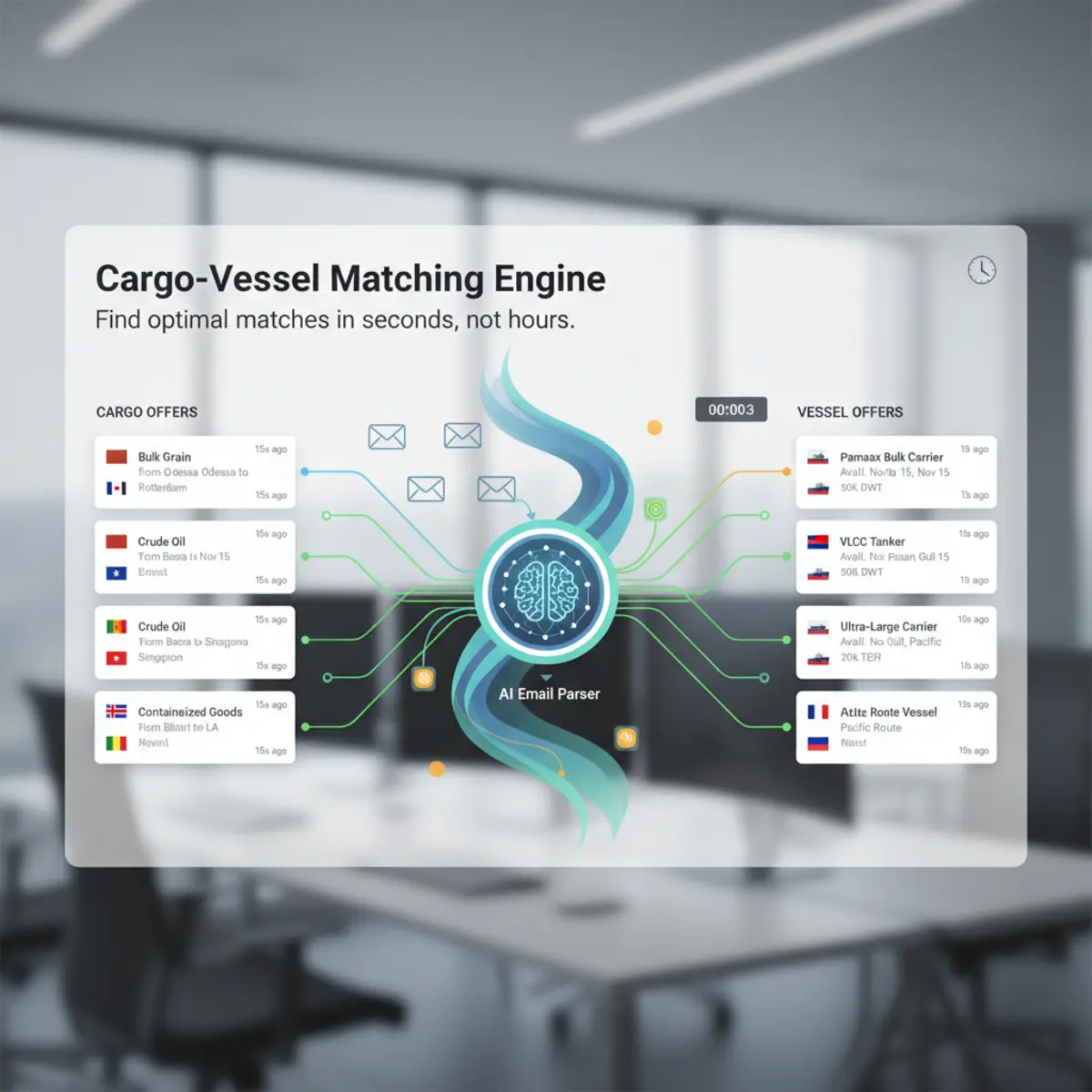
The Challenge of Unstructured Location Data in Maritime Inboxes
Shipbroker inboxes receive thousands of daily circulars containing open vessel positions, order requirements, and freight indications. Because these messages originate from diverse global counterparties communicating under tight commercial timeframes, location information is rarely formatted consistently.
A single commercial port or loading zone can appear under dozens of permutations. For example, a requirement loading in the Amsterdam-Rotterdam-Antwerp range may specify a specific terminal like Botlek or Maasvlakte, a shorthand abbreviation like Rdam or Antw, an overarching trading zone like ARA, or a functional description such as passing Flushing for orders. When chartering desks rely on conventional text searching, these informal variants create substantial operational blind spots.
Without normalization, an inbox search for open tonnage at a specific port fails to surface circulars using alternative spellings, terminal designations, or regional acronyms. Consequently, commercial operators risk missing relevant matching opportunities or wasting manual effort cross-referencing disjointed message threads.
Common Maritime Location Variations and Mapping Examples
| Raw Email Variation | Canonical Location / Area | Category | Operational Consideration |
|---|---|---|---|
| Rdam Botlek 1sb | Rotterdam (Botlek Terminal) | Berth / Terminal | Requires association with parent port and berth constraints |
| S'pore anchorages | Singapore | Regional Shorthand | Identifies standard bunker and bunkering/delivery anchorage |
| P. Kamsar bauxite tml | Port Kamsar | Terminal / Cargo-Specific | Indicates dedicated mineral export berth with draft limits |
| 1 sp USG / Miss River | US Gulf (Mississippi River Range) | Multi-Port Geographic Range | Defines broad regional boundary rather than a single terminal |
| Qingdao ore pier | Qingdao | Facility Identifier | Maps specialized terminal back to commercial port boundary |
| Iskenderun (ex Alexandretta) | Iskenderun | Historical / Transliteration | Resolves alternate geographical nomenclature to current port |
| 1-2 safe ports WCI | West Coast India | Geographical Range | Requires parsing regional trading bounds for laycan suitability |

Why Literal Keyword Search Fails on Broker Circulars
Standard database filters and mail client keyword queries rely on exact string equivalence or simple wildcard pattern matching. In maritime commercial communication, literal searching creates two primary points of operational failure: false negatives and false positives.
False negatives occur when a broker queries a standard location name, such as Singapore, but incoming circulars describe the vessel position as S'pore, SG SIN, or off Jurong Island. The keyword filter excludes valid offers simply because the characters do not match.
False positives occur when broad substrings match unrelated geographical names or non-location terms. For instance, querying a short text string like Port can return unrelated operational notes, charterparty terms, or completely different geographic entities. Furthermore, polysemous names—such as multiple global ports sharing the name Santiago or Newcastle—cannot be differentiated by string search alone, requiring deeper contextual analysis.
Disambiguating Port Names Through Commercial Context
Resolving ambiguous maritime locations requires evaluating surrounding contextual markers within the email rather than analyzing location strings in isolation. Maritime circulars contain operational clues that clarify intended geographic entities.
Cargo types and volumes provide strong contextual constraints. An order specifying 65,000 metric tons of bauxite loading from Kamsar points unequivocally to Port Kamsar in Guinea, whereas grain or clean petroleum products identify entirely different trade corridors. Similarly, vessel deadweight and deadweight draft limit candidate terminals to those capable of handling the specified vessel size class.
Geographic pairings also resolve ambiguities. When an email lists a load port alongside a discharge range such as Japan-Korea Range (JKR) or Continent, the route structure limits candidate load or discharge locations to commercially sensible trading lanes. Evaluating these adjacent elements prevents misallocation of identical port names across different continents.
Data Pipeline for Normalizing Ingested Maritime Locations
- 01
Message Ingestion
Email content from authorized broker circulars is extracted and prepared for entity identification.
- 02
Location Entity Extraction
The parser detects location mentions across load, discharge, delivery, redelivery, and vessel position fields.
- 03
Contextual Boundary Analysis
Extracted text tokens are evaluated against vessel particulars, cargo commodities, and directional trading ranges.
- 04
Canonical Disambiguation
Location tokens are mapped to standard geographical records, resolving informal aliases, terminal names, and abbreviations.
- 05
Structured Offer Creation
Extracted entities are stored in standardized cargo or vessel offer records alongside raw source snippets and confidence indicators.

Handling Port Ranges, Terminal Designations, and Transfer Zones
Maritime trade frequently involves broader geographic zones rather than specific single-port calls. Contracts and order circulars regularly specify options such as 1 safe port US Gulf, Continent / Mediterranean, or North China Range (NCR).
A robust location processing framework must preserve whether an extracted entity represents a specific terminal, a single commercial harbor, or a broad trading range. Forcing a multi-port range into an arbitrary single-point coordinate destroys essential commercial flexibility.
Similarly, specialized offshore operations—such as ship-to-ship (STS) transfer areas, lightering anchorages, and canal transit waypoints—must be categorized accurately. By distinguishing precise terminal facilities from broad regional options, chartering systems preserve the exact intent of the original broker circular for downstream evaluation.
Example of Raw Message Extraction and Structured Attribute Resolution
A raw broker position circular arrives with the following content: MV Atlantic Trader - DWT 58,000 - Open Rdam Botlek 12-14 May - Intention West Africa.
When evaluated through a structured extraction workflow, the system identifies the vessel entity (MV Atlantic Trader), the deadweight capacity (58,000 DWT), the open laycan dates (12-14 May), the open location (Rotterdam, Botlek Terminal), and the intended trading direction (West Africa Range).
The open port string Rdam Botlek resolves to its canonical port entity, Rotterdam, with a sub-location identifier for Botlek. The record retains the original text string alongside the structured data, allowing chartering operators to verify the raw phrasing whenever commercial nuances require human confirmation.
Evaluating Static Master Databases versus Contextual Location Parsing
Many early maritime systems attempted port standardization through static lookup spreadsheets containing lists of known UN/LOCODE entries and port aliases. While static tables handle exact matches for standard codes, they exhibit severe operational limitations in production environments.
Static tables cannot adapt to evolving abbreviations, novel private terminal names, or idiosyncratic broker spelling errors. When a circular introduces a combined trading descriptor such as Skaw-Passero range or an unfamiliar berth abbreviation, a static table fails to resolve the entity or assigns it to an incorrect default.
In contrast, contextual parsing architectures evaluate sentence syntax, prepositional structure (such as loading at, discharging at, or delivering DOP), and surrounding commercial parameters. This structural awareness maintains extraction reliability without requiring continuous manual maintenance of brittle keyword lists.
System Boundaries: Location Normalization versus Downstream Operations
| Operational Activity | Location Normalization Scope | Excluded Downstream Functionality |
|---|---|---|
| Identifying Port Mentions | Extracts load, discharge, and open port strings | Does not verify berth availability or port congestion |
| Standardizing Aliases | Resolves shorthand and typos to canonical port entities | Does not calculate sea distances or bunkering requirements |
| Classifying Port Ranges | Categorizes regional trade options (e.g., USG, JKR, ARA) | Does not compute freight rates or Voyage TCE estimates |
| Extracting Laycan Dates | Associates port entities with laycan window dates | Does not predict live vessel ETA or track AIS positions |
| Creating Offer Records | Generates structured records retaining raw text | Does not negotiate terms, send recaps, or execute fixtures |
Structuring Location Records for Matching and Inbox Governance
Standardized location data serves as a foundational layer for bilateral matching workflows. Once cargo orders and vessel positions share a common geographical taxonomy, chartering desks can execute cargo-for-vessel and vessel-for-cargo searches without manual cross-referencing.
In LaycanMatch, authorized broker emails are parsed into discrete cargo and vessel offer records. Because a single market circular often contains multiple orders or fleet positions, one incoming email can generate multiple distinct offer records. Each record preserves the source email reference, raw message text, extraction confidence, and an explicit review state.
This structured governance model ensures that chartering teams can audit every parsed location against the original source text, maintaining data integrity while streamlining day-to-day commercial review.
Step-by-Step Operator Review Workflow for Normalized Records
- 01
Inbox Notification
The operator inspects new structured offer records generated from parsed broker communications.
- 02
Context Verification
The operator checks the normalized port entity against the displayed raw text snippet to verify complex berth or range details.
- 03
Review State Confirmation
The operator updates the record status from pending review to verified or flagged for adjustment.
- 04
Matching Execution
The operator runs cargo-for-vessel or vessel-for-cargo matching against verified commercial parameters.
- 05
Commercial Follow-Up
The desk initiates direct communication with counterparties using confirmed offer details.
Getting Started with Governed Email Parsing in LaycanMatch
Implementing structured email processing enables chartering desks to manage high message volumes without adding administrative overhead. LaycanMatch provides a governed environment for converting authorized broker emails into structured cargo and vessel offer records.
New accounts receive a 1,000 processed-email free allowance to evaluate parsing workflows across their standard inbox circulars. For ad-hoc evaluation, the public parser offers zero input-text retention after its response, allowing teams to test extraction behavior on individual circular snippets without storing confidential text.
By establishing reliable location parsing and preserving full visibility into raw source data, commercial desks can systematically organize market intelligence, enhance matching precision, and support structured chartering decisions.